On a related note, here is some advice to the noobs running the plains this year. When you stop in a town in tornado alley, keep in mind most everyone living there has had a bad experience with mother nature at some point. Not everyone you run into is going to share your enthusiasm for maybe seeing a tornado close to (or in) that town in a few hours. Be respectful and remember these people may not be excited about the prospect of "explosive development" and "long tracked violent tornadoes". They may be scared as hell. Maybe they had a friend or relative killed or injured in the past. Fair warning...keep things in perspective and always, ALWAYS, keep things on a professional level.
Next rant. I'm not the broadcast media. I'm not the weather service. I'm not the storm prediction center. Seems like a lot of people on FB and a weather forum or two are trying to pass themselves off as such. I'm a chaser. You have access to the same information I do. USE IT. I had an instance this week where a co-worker seemed irritated I didn't take the time to text or call them about the tornado in Minneapolis this past Sunday. IT'S NOT MY JOB!! Pull your head out of your butt and pay attention to the world around you. Most of the NWS WFO's have FB pages now. Maybe a little less time on Angry Birds and little more time on reality is needed. Just sayin'. And while you are at it, pick up a weather radio.
OK, back to the real topics for this entry.
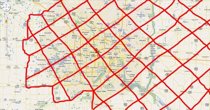
1) My personal NO CHASE ZONE. Chasing in suburbs and urban areas is plain stupid. I don't care if you think you have brass balls and have seen 1,137 tornadoes in your chase career. In 2003 I did it and thanks to John and Jane Public, I could have gotten killed. You can take the best chaser on earth and put him (or her) into a road network where then cannot move at will and cannot see and they are at the mercy of those around them. You think animals get squirrely in bad weather? Take a bunch of urbanites, throw in a scary (or deadly) sky and you have the recipe for chaos and disaster. Overpasses are the least of the worries. Oh, and I firmly believe no responsible chaser would make a choice to attempt this but to each their own. I am far from being the chaser police as I have my own vices and do not claim to live in a glass house. Pretty sure if the worst case scenario plays out and a chaser gets killed, they won't be remembered for being a hero. They will be remembered for making a fatal MISTAKE.

The hatched out area on this map is the areas I stay out of. The small exception is the I94 corridor proper in Wisconsin from Hudson over to Eau Claire. It has to be well worth the effort and the storm vector has to be such they will cleanly cross I94 for a one and done show.
2) On to the storms.
The full chase account and pics can be seen HERE. It includes a bigger map and explanation of the no chase zone.

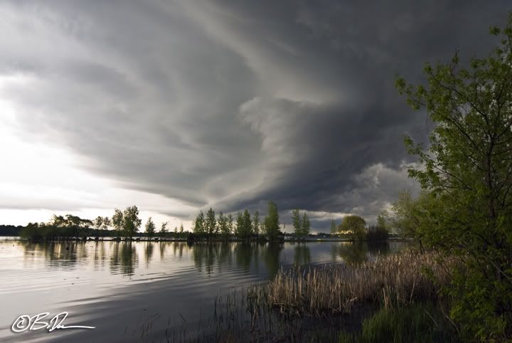
After dinging around with some severe storms coming out of McLeod county near Howard Lake, MN, the best show was actually when we got home. This weird corkscrewed leading edge liner something something updraft ended up be a prolific hailer in a very small place. Namely over Melinda's house.

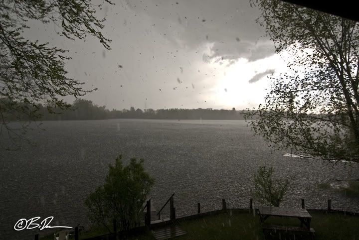
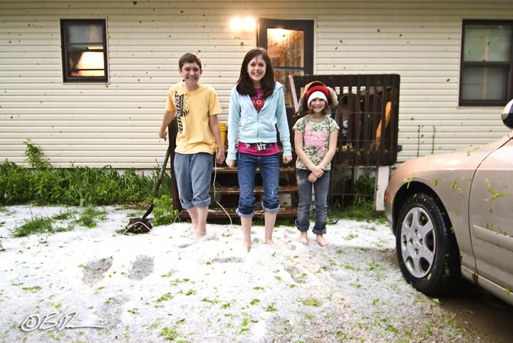
This little sucker pumped out COPIOUS amounts of nickle sized hail for over 10 minutes! Note in the center of image the guy in the boat trying to get back to shore. Stupidity should be painful!

The hail roar with the cell was pretty intense. At one point it had me second guessing what was going on as the sound was pretty similar to June 16th last year when I got winged by a rain wrapped vortex near Dupree, SD. Well, the trees look like crap now and there will not be a raspberry crop either. Pummeled. No other word to describe it.
On the horizon it looks like a pretty significant weather pattern change is in store for us starting next week. As usual the Memorial weekend weather will suck up here. But starting Monday real heat and humidity will show up and hang around for a while. With it there is a lot of energy and wind shear. Now we just need a trigger and the wait may pay off. It has been really hard to sit out the events down south this year. I just hope my wager on the northern plains pays with some fantastic storms on less than crowded roads.

1 comment:
We might even get an eastern Dakotas chase sometime soon!
Post a Comment