The complete set of images and the watered down chase log can be found HERE.
This was a great lesson in always leave early and be prepared to adjust the initial target en-route as conditions changed. The only surprising thing about this day was how little the the surface features moved. Everything moves slower during the daytime in June and accelerates at night but this was ridiculous.
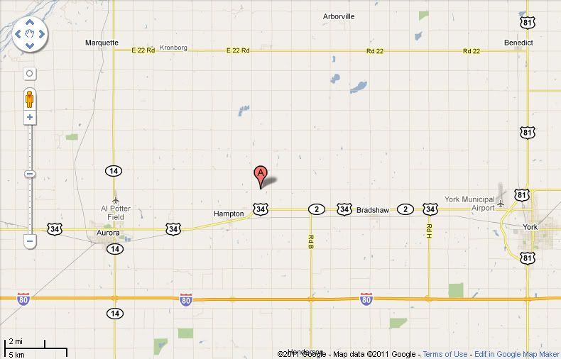
My long-time chase partner and photography mentor, David Drufke, and his wife, Kristen, were with on this trip as we initially targeted Norfolk, NE. Upon arriving in Norfolk we never slowed down as the Hastings, NE NWS radar showed a ridiculous BR return clearly showing the arcing warm front with the arcing dry line just south of it wrapping into the surface low just to the west. Got to Columbus and dropped southwest on the south side of the Platte as storms began to fire in earnest. As we dropped straight south towards Aurora, I made the comment to David the strategy of going straight at the developing cells was going to work as the east-west adjustment to pick the dominant supercell (usually on the east side of the arc in my experience) was going to be a cinch. A little hail-ridden, but still easy. As we neared Aurora, one cell had the VIL spike and it was go time so east on 34 to 4 miles east of Hampton and 4 miles south just north of I-80 it was show time:
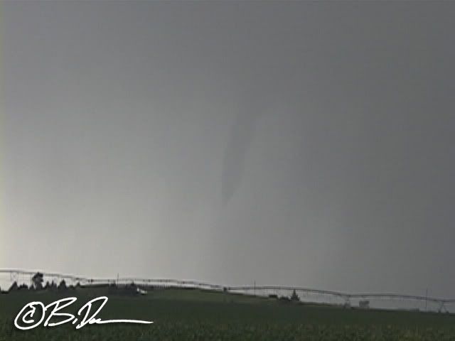
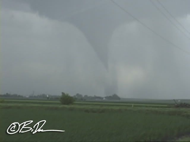
Looking south/southwest from out position 4E/4S of Hampton. I have no idea if this really touched down or not. Some chasers on I 80 said it did but I know for sure this is NOT the start of the Hamilton county EF2 as it totally dissipated, formed another ropey funnel (image on the website) then produced the 1/4 wide torn.
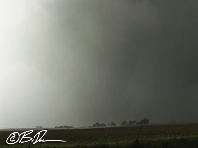
Partially wrapped in rain and hail, this IS the Hamilton county EF2 as we flanked it to our west about a mile north of Hampton going north on the east side of town.
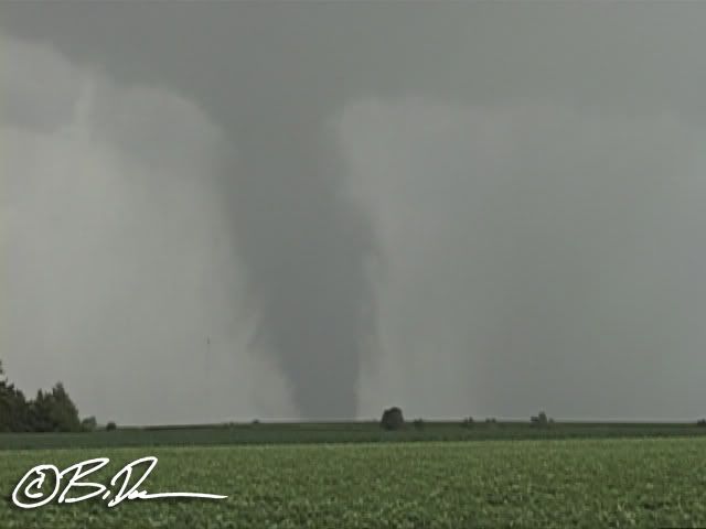
As we pulled over to let the big torn cross the road in front of us, I kept telling Kristen to watch to the south of us. As we took a pretty decent RFD blast from the EF2, I looked back over my shoulder to see the Bradshaw torn touch down (image above). This was an EF2 also. As we watched the torn to make sure it wasn't going to curl back to the northwest towards the surface low, I looked back north at the 1/4 mile wide Hampton tornado which was moving north away from us and dissipating when I saw this:
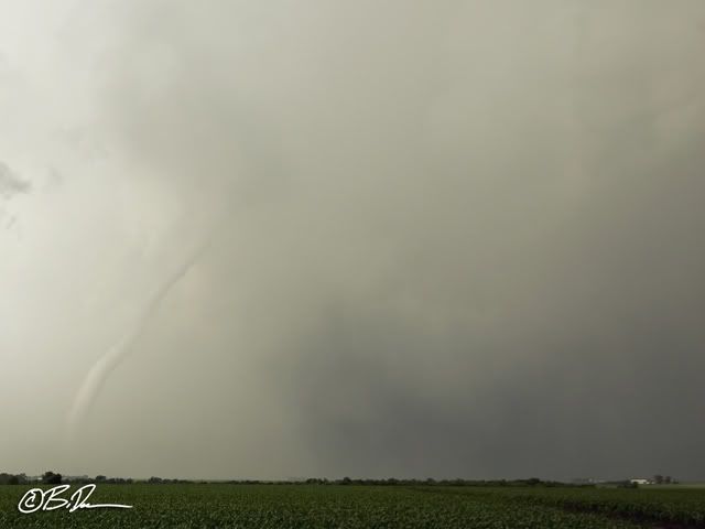
A white rope coming out the back side of the cell to the west/south west of the larger torn. So, at this time, there are 3 tornadoes on the ground at the same time we can see from our position here:
The rope dissipated quickly so we went after the Bradshaw torn which now roping out. The cell cycled and this torn eventually go on to be a very nice EF3 stovepipe which unfortunately went on to produce damage just east of the town of Polk, NE. We passed by a farmstead where the top half of the residence was sheared off. There was no EM on scene yet but it looked like there were a lot of neighbors on scene already so we continued on, snaking our way up towards Osceola and Silver Creek where we broke off the storm as it went outflow dominant. Back through Columbus and up to Sioux City for something to eat then a 5 hour drive in a power wash as the arc of convection made it's way into Minnesota and home. About 1000 miles and up for 24 straight hours, but totally worth it!

No comments:
Post a Comment